Geospatial-AI
Objective
To develop a deep learning model to estimate the timing of phenological events over large area

To develop a model to estimate the timing of phenological events over large areas from time series of earth observation data using vision transformers, a fierce alternative to tra

Global production, transportation, and consumption of oil can cause inevitable spills into the environment (typically from pipelines, oil wells, and storage facilities) cont
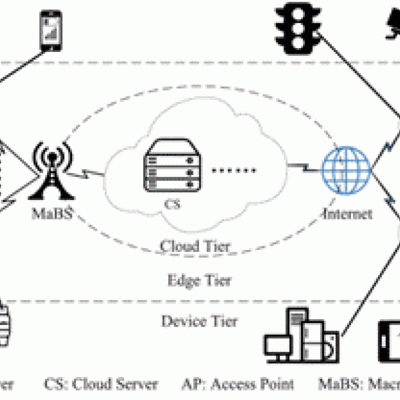
Unmanned Aerial Vehicles (UAVs) are increasingly used within a Mobile Edge Computation (MEC) network where the UAV is made intelligent by equipping it wit

Unmanned Aerial Vehicles (UAVs) are increasingly used by public and private organizations such as the Politie, Brandweer or Rijkswaterstaat.

In the past couple of years, Neural Radiance Fields (NeRF) [1] and methods derived from it have become a popular choice for solving different tasks such as novel view

The climate in cities and metropolitan areas (i.e., urban climate) is often different from the climate in the surrounding rural areas due to the presence of buildings, pavement, a

The Antarctic ice sheet covers almost the whole area of the Antarctic continent. It is the largest ice mass on Earth, with an average ice thickness of about 2 kilometers [1].

LINK TO RESEARCH PROJECTS
The MSc topics link to several ongoing larger research projects that allow being part of international research teams - both projects just started:

Generative Design is an umbrella term for a variety of approaches to the derivation of topological-geometric configurations directly from the design requirements and goals in a feedforward process