Geospatial-AI
Humanitarian organizations such as the Red Cross Red Crecent and Unicef use risk models to identify vulnerable populations and mitigate the affects of natural disasters.
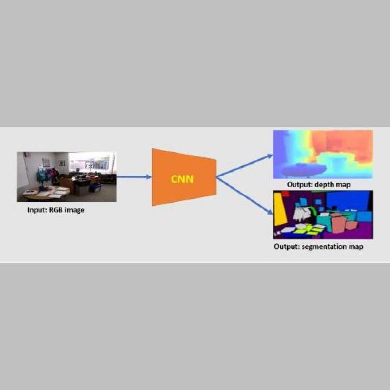
Indoor scene understanding is important for tasks like indoor navigation and semantic mapping.
With down-looking satellite sensors, our three-dimensional (3D) world is commonly represented with 2D remote sensing images.
The challenge of this topic is to detect a change or trend on top of seasonal fluctuations.

The presence of noises, clouds and another atmospheric phenomena represent an obstacle for optical remote sensing applications.

The estimation of depth from a single image have been a Computer Vision topic for decades.

Object detection is a fundamental topic in computer vision. Recently, deep learning has become an effective method and achieved great success in object detection.