Forest responses to disturbances along Samaria-Lefka Ori National Park (Crete) using a multisensor approach
Field data collection can be done in the study area, otherwise the data from the field campaign in 2018 will be used.
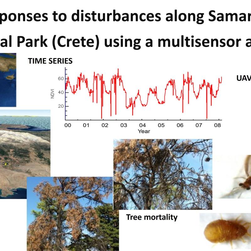
Frequent persistent drought events in Mediterranean ecosystems and insect attack have generated an extreme level of tree mortality and forest health deterioration making Mediterranean ecosystem more susceptible to wildfires. In addition, more extreme climate event, such as drought are expected as global warming progresses, thus more forest mortality and forest deterioration will be expected in the future specially in semiarid regions. Understanding the main drivers of tree mortality is critical for forest manages and forest agencies in order to quantify the damage and to develop restoration plans.
The main objective of this research is to monitor the evolution of an open coniferous Mediterranean forests under droughts and/or insect attack disturbances in order to estimate the main drivers of tree mortality. The study site is Amaria-Lefka Ori National Park in Crete. Time series of Sentinel-2 data will allow to evaluate forest properties in time, specifically the student will be focus on the loss of vegetation water content assessed using a trend analysis procedure. Time series of meteorological data will be used to identify water stress conditions and their temporal relationship with canopy water content time series. High spatial resolution UAV data and field measurement will be used to validate the results.