Assessing Montane Treeline Movement using Historical Oblique Imagery from Canada
The topic is open for also suitable for GEM students in track 3 – GEM for Ecosystems & Natural Resources.
Suggested elective: Image Analysis
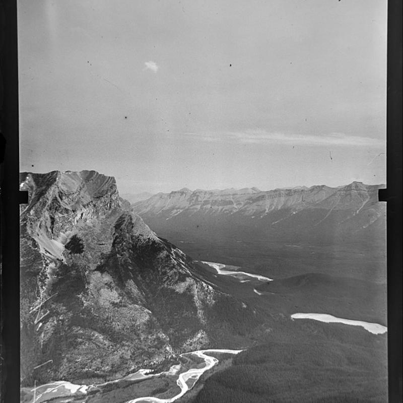
Climate change is expected to affect many natural processes on earth. Vegetation is typically expected to respond to changes in the global climate. Slow growing ecosystems, like trees at their climatological edge high up in the mountains (the treeline), require several decades to show their response. At the same time, at these edges we expect profound impacts of climate change. If climate change will cause the treeline to move to higher altitudes, this will put pressure on montane ecosystems above the treeline. Often these ecosystems above treelines harbour high levels of endemism that require efforts to conserve these species. To observe changes in the position of treelines however, we need long time series of observations. The current satellite archive goes back to mainly the 70’s of the previous century. But with historical imagery from the beginning of that century, we can look at the position of treelines even further back in time. The Mountain Legacy Project in Canada (https://explore.mountainlegacy.ca/) has collected a large database of > 25.000 oblique photographs of mountains and their location in the mountains. In combination with early satellite images like from the Corona Satellite missions from the 60’s and 70’s (https://data.nasa.gov/dataset/CORONA-Satellite-Photography/4rni-qjx7), and more recent images like worldview we can create long timelines of tree line positions and assess to what extent treelines have moved.
In this topic you will assess if and in which direction (upwards or downwards) tree lines have moved in the last century, making use of historical oblique photographs that have been taken nearly a century ago, and comparing this to more recent aerial or satellite based images of the same location. This requires georeferencing and digitizing treelines from different sources of data and assessing whether observed changes are sufficiently significant to make a claim about their movement. Additionally, finding empirical associations with environmental parameters, like slope steepness and orientation, distance from oceans and latitude can be identified to explain possible differences in treeline movement.
- Article on the use of the Legacy project imagery https://doi.org/10.1038/s41598-020-66277-2
- Article that demonstrated treeline detection from Corona Imagery https://doi.org/10.2747/1548-1603.49.6.933