Tsunamis generated by volcanic eruption and flank collapses combining remote sensing, field data and numerical modelling
This is a project that could be undertaken by multiple students working on the characterization of different events.
Coding skills are required for this project.
Suggested elective course:
- Multi-hazard modelling and risk
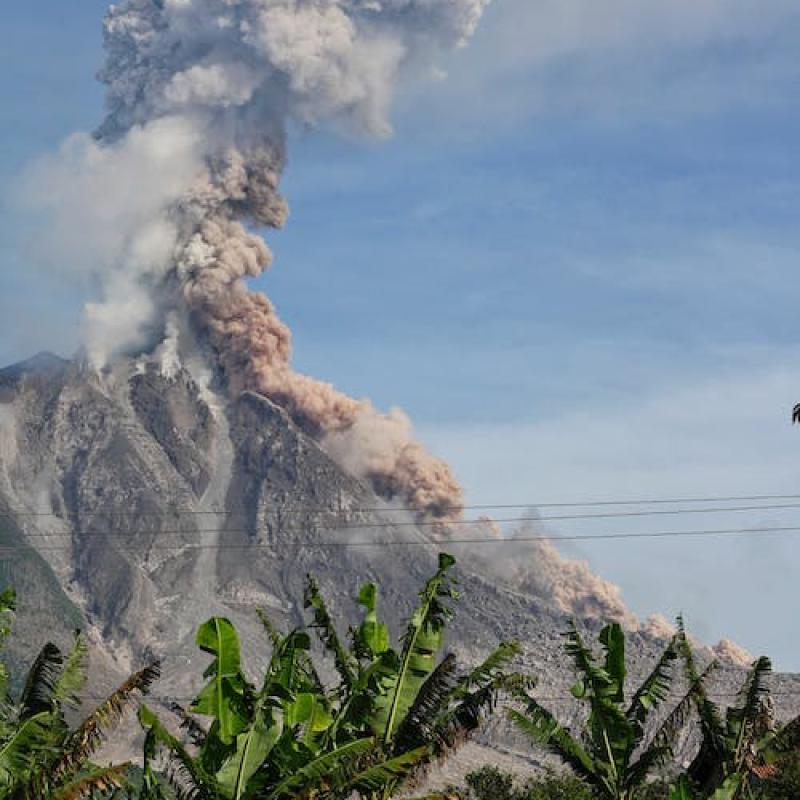
Tsunamis caused by landslides flank collapses and pyroclastic density currents during or after an eruption are cascading hazards that could have destructive and lethal impacts on large area surrounding the volcano. This has been the case for the tsunami triggered during the Anak Krakatau eruption in December 2018 in Indonesia which caused hundreds of fatalities. Nevertheless, these phenomena are still poorly understood as they are unusual, complex events and data are scarce and often not well constrained.
Stromboli is one of the most active volcanoes in the world, and it has been extensively monitored and studied in the last decades (Casalbore et al. 2022, Di Traglia et al. 2022). Many tsunamigenic instabilities (sub-aerial and/or submarine) have taken places along its flanks including at least 7 since the beginning of the 20th century (Maramai et al., 2005). In particular, after the 30 December 2002 landslide–induced tsunami (Tinti et al. 2006) which caused extensive damage to the coast, a series of buoys have been installed around the island to monitor and record tsunami wave heights in different points around Stromboli at all time. In this framework it is possible to constraint and study events occurred in recent years, where data are available both on the tsunamigenic flows (i.e. proclastic density currents and landslides) occurred along the flank of Stromboli and on the heights of the tsunami waves at different points around the island.
Thanks to the collaboration with the Vesuvian Observatory (INGV) and the University of Rome “La Sapienza”/CNR-IGAG we also have access to data on the geomorphological changes of the island derived by remote sensing analysis and bathymetrical data from regular marine surveys carried out for the Italian Civil Protection.
Using LISEM (van de Bout et al. 2021), a physically based model developed at ITC, you will then be able to back analyse well constrained events. This will contribute in assessing the ability of the model to simulate complex events and to understand these cascading processes. The topic might involve fieldwork to the area in order to obtain further data on soil geotechnical properties and validation data for the models. The model results will contribute to our ability to assess the hazard related to tsunamigenic flows, and improve disaster risk reduction.
The project aims to improve our understanding of tsunamigenic mass flows and the hazard they pose using remote sensing, field data and numerical modelling with a multidisciplinary approach. This approach will be developed and testes for Stromboli volcano since it:
- experiences moderate to large instability events.
- is geomorphologically prone to instability events.
- is affected by active intense volcanic activity that can significantly affect the stability of its slopes.
- flank instability could affect inhabited areas and intensely frequented by tourists.
The proposed work will be carried out in different phases:
- Analysis of the bathymetric and remotely sensed data made available by partners to obtain net elevation changes from pre- and post-event.
- Stromboli flanks stability analysis.
- Mass flow propagation and tsunami generation back and forward analysis using LISEM.
Vary and verify the behavior of initial conditions on tsunami wave heights in the model, and compare with the real observations.
- Casalbore, D., Di Traglia, F., Romagnoli, C., Favalli, M., Gracchi, T., Tacconi Stefanelli, C., Nolesini, T., Rossi, G., Del Soldato, M., Manzella, I., Cole, P., Casagli, N. and Chiocci, F.L. Integration of remote sensing and offshore geophysical data for monitoring the short-term morphological evolution of an active volcanic flank: a case study from Stromboli Island. Remote Sensing (2022), 14(18), 4605; DOI
- Di Traglia, F., Fornaciai, A., Casalbore, D., Favalli, M., Manzella, I., Romagnoli, C., Cole, P., Chiocci, F.L., Nolesini, T., and Casagli, N. Subaerial-submarine morphological changes at Stromboli volcano (Italy) induced by the 2019-2020 eruptive activity. Geomorphology (2022): 108093 DOI
- Casalbore D, Romagnoli C, Bosman A, Chiocci FL (2011) Potential tsunamigenic landslides at Stromboli Volcano (Italy): Insight from marine DEM analysis. Geomorphology 126(1):42-50
- Maramai, A., Graziani, L., & Tinti, S. (2005). Tsunamis in the Aeolian Islands (southern Italy): a review. Marine Geology, 215(1-2), 11-21.
- Tinti S, Pagnoni G, Zaniboni F (2006) The landslides and tsunamis of the 30th of December 2002 in Stromboli analysed through numerical simulations. Bull. Volcanol. 68(5):462-479
- van den Bout, B., et al. (2021) Towards a model for structured mass movements: the OpenLISEM hazard model 2.0a. Geosci. Model Dev. 14(4): 1841-1864.